


 Opemiska Property


 DESCRIPTION OF THE OPEMISKA PROPERTY The Opemiska property owned at 100% by Ex-In has a surface
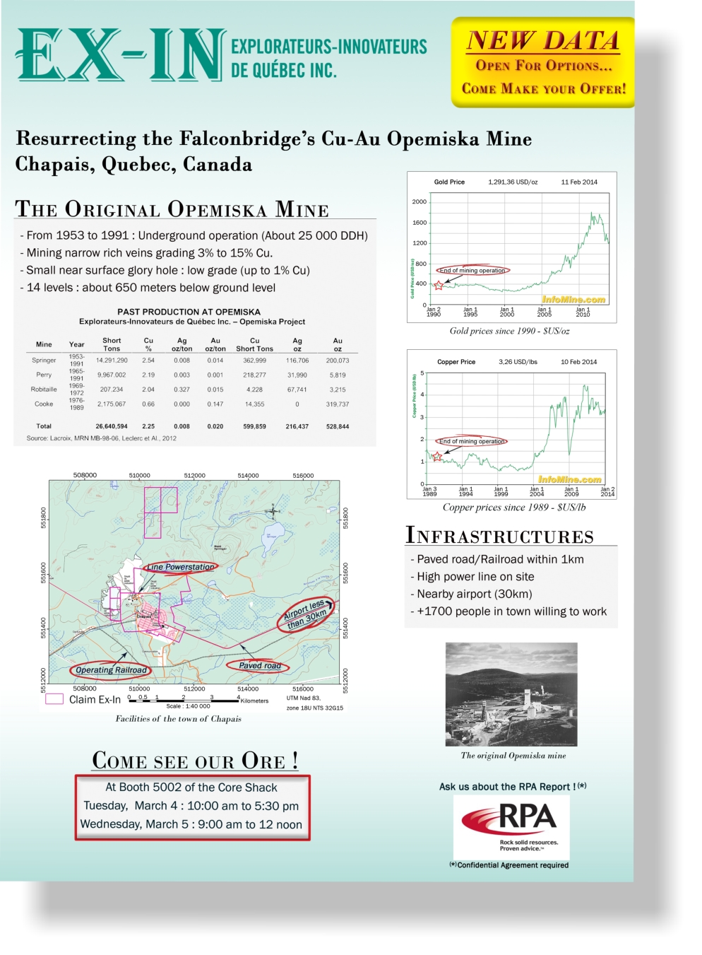
 of 5 km² and englobes two former underground copper-gold mine: the Springer and the Perry mines. Both were mined between 1953 and 1991, targeting narrow but rich veins. The first years, the ore sent to the mill averaged over 6% copper. Later the grade of ore sent to the mill went down to less than 3% Cu, partly because some of the ore came from a small glory hole. Today, many former underground mines are being mined using open pit to extract large volumes of lower grade ore. So far, 14,504 DDH and 303,433 assays were digitized from original logs and hundreds of maps and sections were digitized and geo-referenced. All this work has allowed us to build a 3D view of the old infrastructures and DDH (Figure 9) and thus, help us determine the geological potential and to define more accurately areas of potential. Since 2013, the collaboration with our group of consultants RPA (Roscoe Postle and Associates) allowed us to define, between 500 and 1,500 feet below the surface, a large volume of ore with economic values of copper and gold. GOAlS We believe that this ore can be mined with profit by an efficient bulk mining operation, either from the surface or underground high volume, such as at Gaspé Copper and there is enough ore available in Springer and Perry mines to start an open pit mine. The main objectives for Ex-In in the coming months are: 1. Define with new drilling the surface’s extension of the mineralization present between 500 and 1500 feet deep in the Springer mine 2. Define new mineralized zones as a result of the geophysical compilation which will be carried out by Frederic Gaucher within his Master in the Laurentian University in Sudbury. 3. Continue the development of the property PROPERTY LOCATION The Opemiska mine property is located in Chapais and is easily accessible from Montréal via Highway 113 or from Quebec City from Highway 167, then Highway 113 (Figure 1). CLAIMS Ex-In owns eleven claims in the vicinity of the Opemiska mine (Figure 4) which total 684,86 hectares (Table 1). Claims are 100% owned by Ex-In. Eight of the claims cover the Springer and Perry past producing mines and total 518.23 hectares. BACKGROUND – CHIBOUGAMAU-CHAPAIS MINING CAMP The Chapais-Chibougamau mining camp is the second largest mining district in the Quebec part of the Abitibi greenstone belt. The camp has produced approximately 86 million metric tonnes of ore from 1953 to 2008, including 1.57 million tonnes Cu, 176.1 tonnes Au, 108.8 tonnes Ag, and 72,066 tonnes Zn (Leclerc and al., 2012). Production at Opemiska started in 1953 and ceased in 1991. Production tonnage was extracted from four mines, namely the Springer, Perry, Robitaille and Cooke mines. A total of approximately 600,000 short tons of copper, 216,000 ounces of silver and 529,000 ounces of gold have been produced from 26.6 million short tons of milled ore. Mineralization in the Chapais-Chibougamau area is classified into the following types (Leclerc and al., 2012): • Syn-magmatic Fe-Ti-V and Ni-Cu platinum group element (PGE) mineralization in mafic-ultramafic layered complexes and sills. Fe-Ti-V deposits occur within the Layered zone of the Lac Doré Complex, especially where it thickens in areas of interpreted syn-magmatic faults. Sub-economic magmatic Ni-Cu deposits occur at the contacts of mafic-ultramafic or tonalitic intrusions. • Syn-magmatic “Chibougamau-type” Cu-Au veins formed through magmatic-hydrothermal processes. They are cut by dikes that predate regional D2 deformation but are located within, and are deformed by, north-west and north-east rending D2 shear zones. • Syn-magmatic early polymetallics Au-Ag-Cu-Zn-Pb veins associated with north/north-west to north/north-east-striking syn-volcanic faults. • Syn-volcanic volcanogenic massive sulfide (VMS). VMS deposits occur within felsic volcanic rocks of tholeiitic affinity and mafic to felsic volcanic rocks of transitional to calc-alkaline affinity at the top of three volcanic cycles of the Roy Group. VMS deposits are associated with north/north-west to north/north-east-striking syn-volcanic faults. • Shear zone hosted “orogenic” Cu-Au and Au. o “Opemiska-type” Cu-Au veins occur within regional overturned anticlines in mafic sills of the Cummings Complex. Veins in the Chapais area are developed in east-west reverse D2 shear zones that parallel the axial surface of the Beaver Lake anticline in the upper gabbro of the Ventures sill. These veins are also reoriented into north-west/south-east D2 shear zones and faults. o Au deposits are developed preferentially within regional east- west–trending deformation corridors and along north/north- east-striking sinistral shear zones. GEOLOGY The Opemiska mine is located in the northeastern Abitibi greenstone volcanic belt just west of the town of Chapais (Figure 5). The area is underlain by Archean rocks of the Obatogamau and Gilman Formations (pillowed basalts and gabbro sills) and the Blondeau Formation (volcano-sedimentary assemblage). The Blondeau Formation is intruded by the Cummings Complex which consists of three ultramafic and mafic sills, namely the Roberge, Ventures, and Bourbeau sills. The Ventures sill is divided into five members, in ascending stratigraphic order, Lower Green Pyroxenite, Black Pyroxenite, Upper Green Pyroxenite, Foliated Gabbro, and Ventures Gabbro. The Springer mine is located in the Ventures Gabbro. Lithologies have been intruded by the Opemisca granitic pluton. Lithologies are compressed and metamorphosed to the greenschist facies (chlorite-epidote-tremolite). The northeast- trending Gwillim fault has displaced the sequence in the order of 2.5 km. Regional and local structures are important factors controlling the Cu-Au-Ag mineralization at Opemiska which appears to be syn-tectonic to post-tectonic in age. Mineralization is concentrated in networks of veins and veinlets of different orientations with dips generally sub-vertical. Veins occur within regional overturned anticlines in mafic sills of the Cummings Complex. Veins are developed in east-west reverse D2 shear zones that parallel the axial surface of the Beaver Lake anticline in the upper gabbro of the Ventures sill. These veins are also reoriented into north-west/south-east D2 shear zones and faults. Vein width varies from 0.5 ft to several tens of feet. At the Springer mine the ore consists of semi-massive to massive chalcopyrite-magnetite-quartz-carbonate ± pyrite veins and veinlets in a subophitic gabbro (Leclerc and al, 2012). The main metallic minerals observed are chalcopyrite, pyrite, pyrrhotite, magnetite, and gold with minor amounts of sphalerite (locally abundant), gersdorffite and galena (Salmon, 1984). Traces of molybdenite, cobaltite, scheelite, bornite, and malachite are present in the mineralization. The economic mineralization is almost entirely confined to the Ventures sill. At the Springer mine, veins generally strike east-west while at the Perry mine, veins strike generally north-south. The fracture system may have developed during the regional folding. For further details on the Opemiska property, please fulfill the confidentiality agreement to receive the reports written by RPA.
 © Copyright 2014 - All rights reserved
  Fig.3: Diamond Drilling Campaign, held in 2010 Fig.6: Prospecting campaign, held in 2002
 Click thumbnail to enlarge the flyers
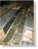
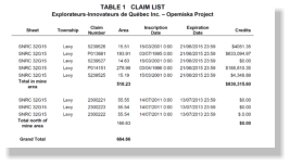 Table 1: Claims List
 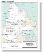 Figure 1: Location Map of the Opemiska Project Click thumbnail to enlarge
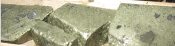
 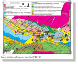 Fig.2 Diamond drilling cores from hole # OP-2010-19: 17% Cu + 1.7 g/t Au / 3m. Fig.5: Local Geology Fig.4: Claims Map
 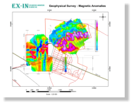 Fig.7: 2012 Geophysical Survey: Magnetic Anomalies
 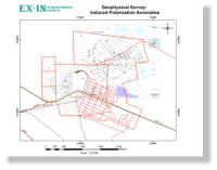 Fig.8: 2012 Geophysical Survey: Induced Polarization Anomalies
 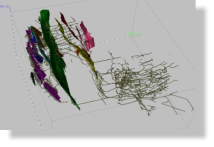 Fig.9: Interractive 3D model of the drifts, stopes and partial geology © Copyright 2019 - All rights reserved
 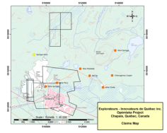 SEE MORE PICTURES OF OPEMISKA Fig.10: Presentation of the Opemiska Property (.PDF)

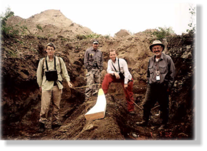
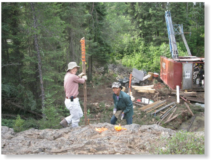 Fig.3: Diamond Drilling Campaign, held in 2010
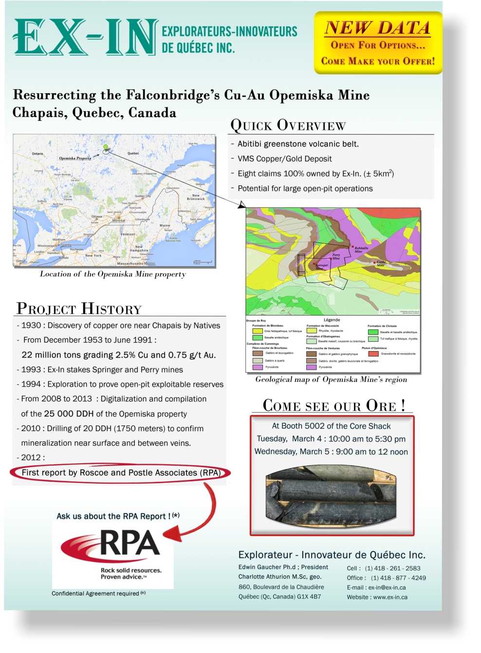
 Click thumbnail to enlarge the flyers
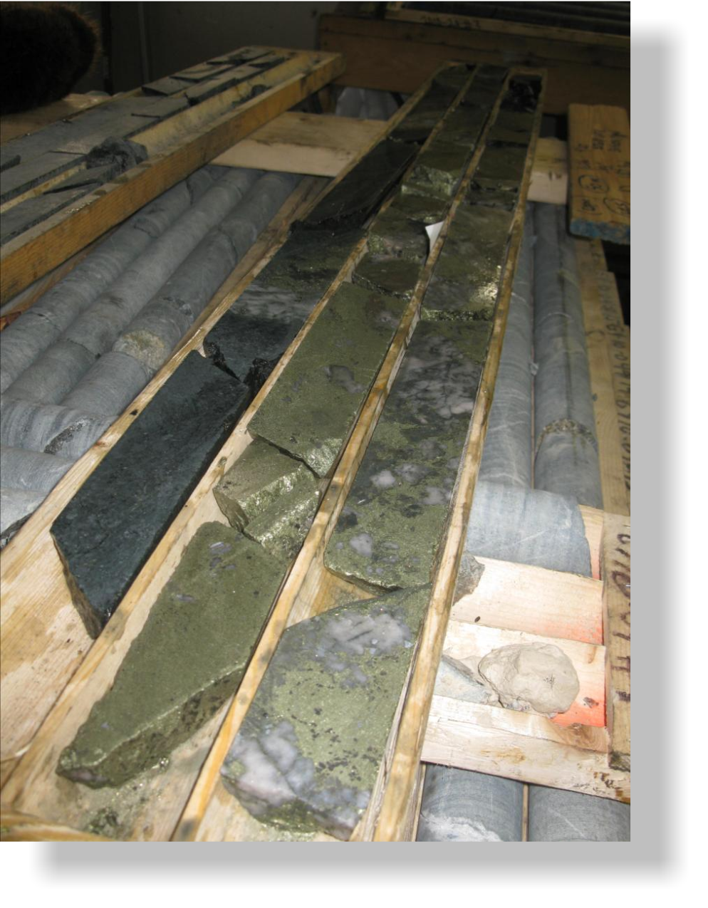
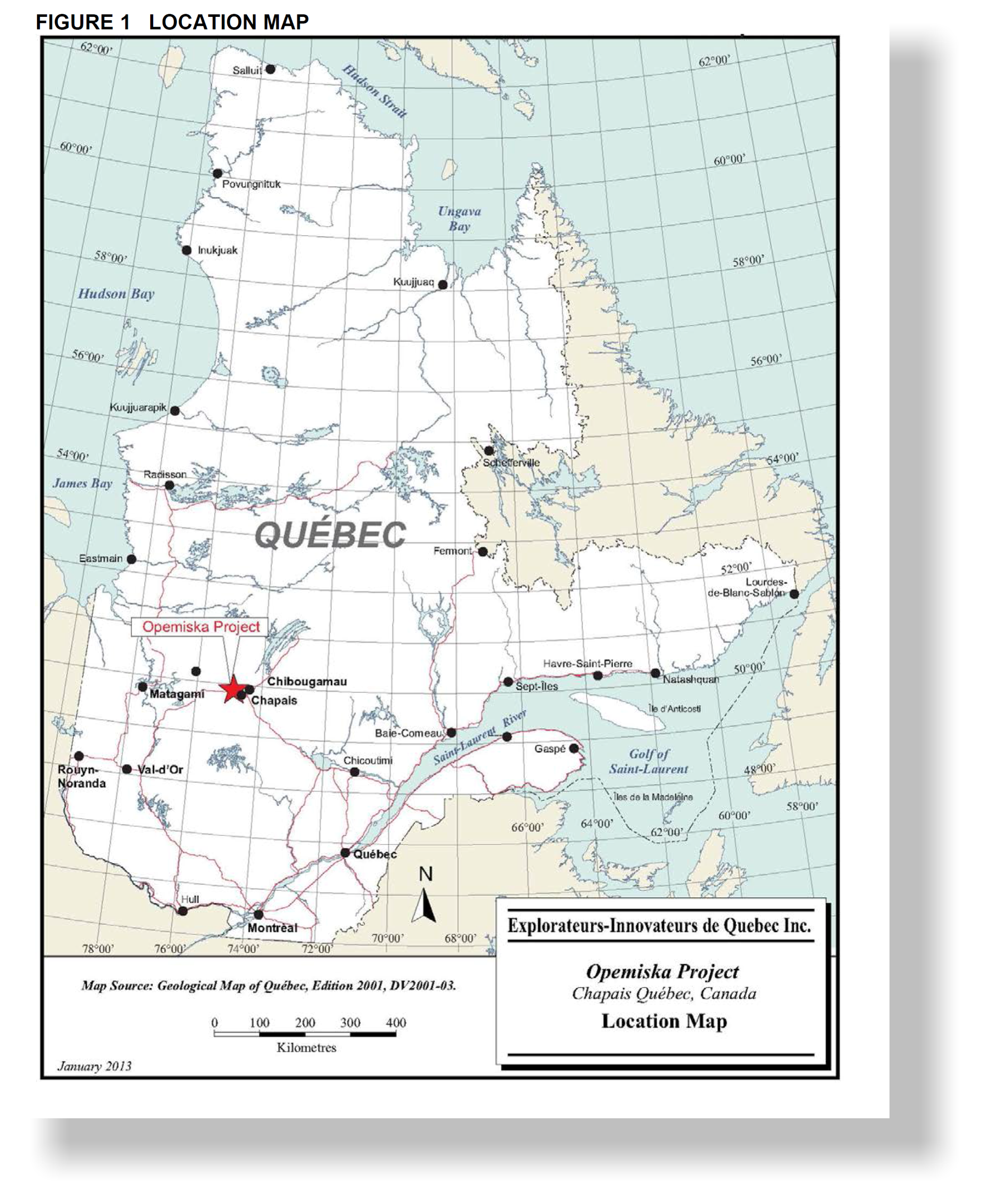 Figure 1: Location Map of the Opemiska Project Click thumbnail to enlarge
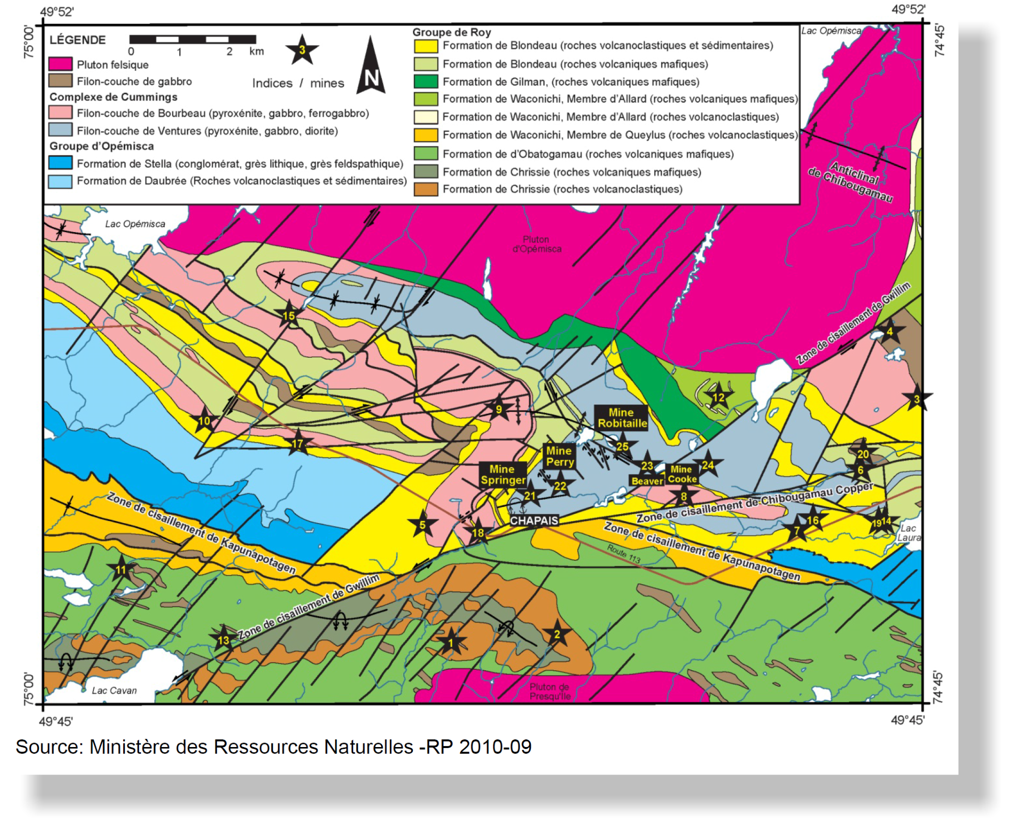 Fig.2 Diamond drilling cores from hole # OP-2010-19: 17% Cu + 1.7 g/t Au / 3m. Fig.5: Local Geology
 Fig.7: 2012 Geophysical Survey: Magnetic Anomalies
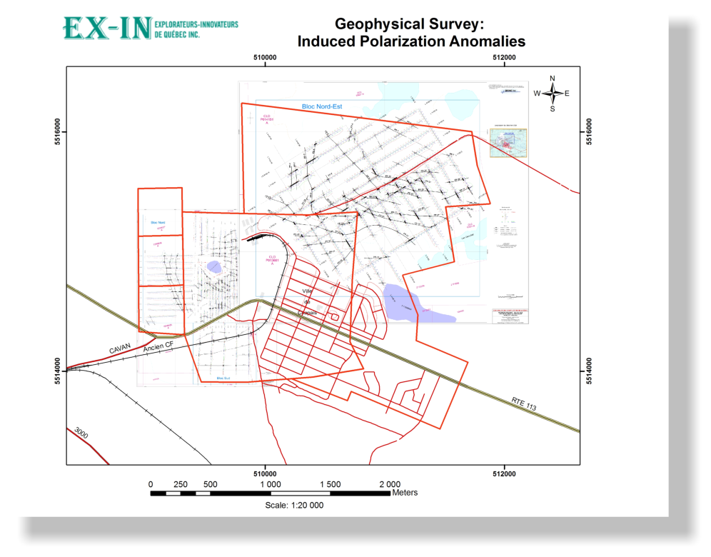 Fig.8: 2012 Geophysical Survey:
 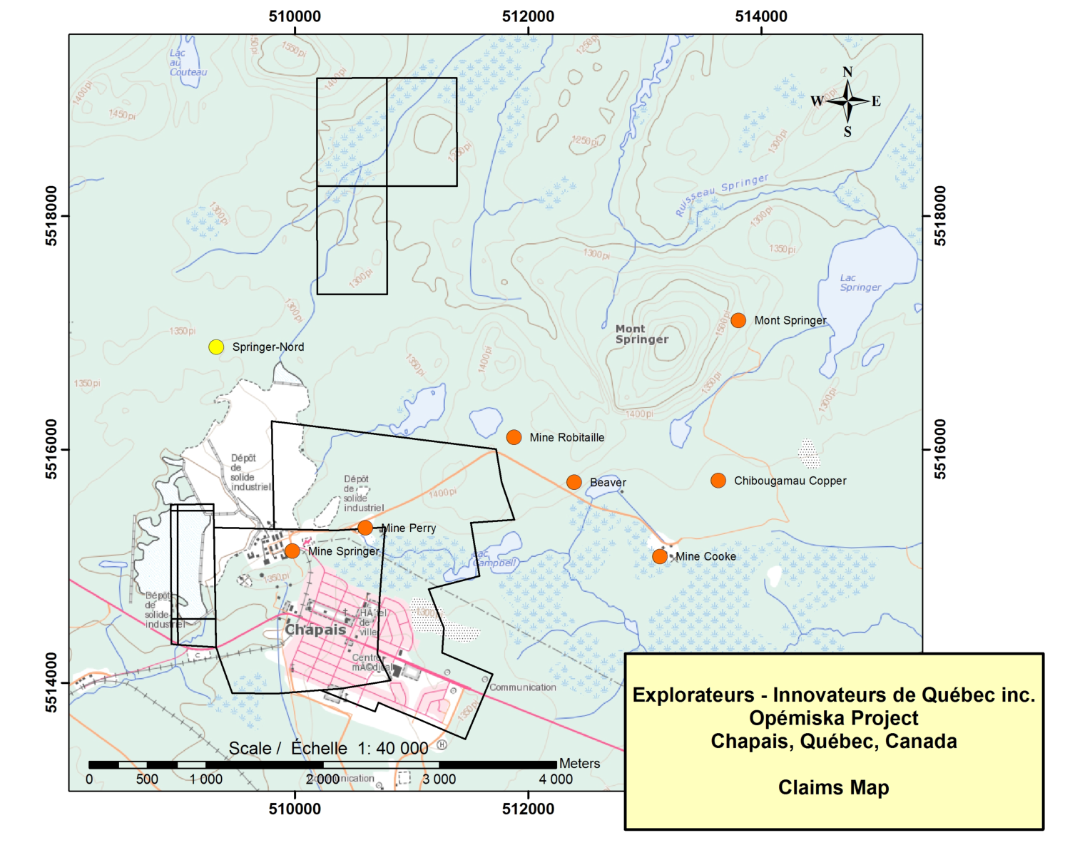 SEE MORE PICTURES OF OPEMISKA Fig.10: Presentation of the


